By Kimberly Ramkhalawan
June 18, 2021
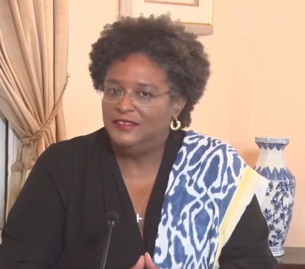
Barbadians are questioning their local Meteorological office on what exactly transpired between Wednesday night and Thursday morning. This after a freak storm left much devastation to the island. On Thursday evening, in what would have been her COVID-19 Press conference, Barbadian Prime Minister, Mia Amor Motley instead addressed what she calls nothing but a freak event shortly after midnight.
Residents on the island described it as an intense electrical storm, as over 490 lightning strikes per minute, and a total of 46,290 strikes were recorded. Prime Minister Motley herself, described the roaring of thunder she heard as unusual, as it sounded like it came from the belly of the earth, while high winds and gusts raged.
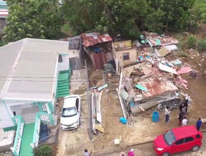
Several homes lost roofs leaving much of their contents water logged, while residents say they felt traumatized following last night’s event, going as far as saying it was worst than Tropical Storm Tomas the country faced back in 2010.
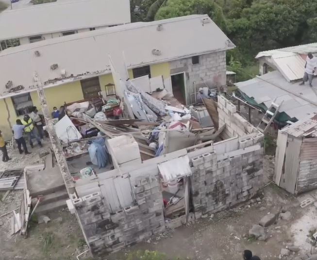
Attorney General, Dale Marshall who is also MP for St.Joseph, visited his constituency and assured that they were working at finding immediate accommodations for residents, while its Ministry of People Empowerment and Elder Affairs, were working to assist affected persons in getting back on their feet.

In his attempt to explain what happened, Acting Director of the Barbados Meteorological Services Sabu Best speaking at the virtually held press conference along with the PM, said while it issued an alert of heavy rains earlier, what developed closer to midnight is described as a mesoscale convective system, a small vortex that developed east north east, they were keeping an eye on.

He says these systems are very short lived, and its distance was 150-200 kilometers away and was contemplating the most appropriate time to issue a warning as most often these types of systems form and quickly dissipate. However, this did not occur, catching most of the residents off-guard as they slept during the night, resulting in much of the destruction.
Best says an alert was issued via its mobile app, only when the system had reached 25 kilometers off the island, expressing that there would be excessive rainfall and thunderstorm activity.
While he added that much of the intense rainfall occurred in central parts of the island resulting in five to six inches of rain in under two hours, Cambridge, St. Andrew recorded 168 millimeters per hour.
And while he understood the frustration of the people, he explained that such weather systems were common in tropical regions, and underscored the importance of being ready for sudden onsets of bad weather for short periods of time.
He says the event while it lasted about two hours, it was not classed as a Tropical Storm or a Hurricane, but a feature attached to the tail end of Tropical Wave 9 which passed earlier in the day.
Best says while alerts were issued from the previous day warning of excessive rainfall, he says going forward, the Met Service will look into improving its communications via its alert systems, so that the public will be better aware.
He urged residents ‘to get equipped with these warning tools so they can be well aware of these events before they occur’.
The acting Director at the Met Service added that the system also provided a learning opportunity for staff to put in place better mitigating systems, while utilizing new techniques in analyzing data for better alerts.
Asked weather the recent influx of Saharan dust had an effect on the development of such a system, Best says the dust actually works to weaken any convection from occurring.
Meanwhile, Best says more rain is forecast for the island in the coming days while chances of it being another freak storm are very slim. He instead called on Barbadians to pay attention to their website and app which also gives vocal alerts of pending bad weather, and to be prepared this year as it anticipates additional rainfall come August and September.
Prime Minister Motley chimed in urging residents to be vigilant in the coming few days. And while she says the damages were bad, she still took the chance to give thanks as she understood damages could have been much worse, citing the floods regional neighbour Guyana had faced in recent weeks.
The system is said to have produced winds about 43 kilometers per hour resulting in downed power lines and a shut off water supply across the island. However, its utility companies were said to have restored service to approximately 75 to 80 percent by Thursday evening.